
Parsippany-Troy Hills ZIP Code Coverage and Delivery Leads
The supported local postal leads below are not a township boundary map or a resident list. They identify labels that appear in official township, county, or USPS material, and the caution column tells you where an exact address remains necessary. The Parsippany-Troy Hills ZIP code directory should preserve the returned city, state, ZIP, date, and municipality result for each address checked.
| ZIP code | Supported Parsippany-Troy Hills connection | Post office or postal lead | Verification caution |
|---|---|---|---|
| 07054 | Primary township postal label | Parsippany Post Office, 3299 US Highway 46 | Common township ZIP, but the exact delivery address still controls. |
| 07034 | Lake Hiawatha community and township Parks contact label | Lake Hiawatha Post Office, 494 N Beverwyck Road | Use USPS for the individual address rather than a community label alone. |
| 07878 | Mount Tabor, identified as a township section with its own ZIP code | Mount Tabor postal lead | Confirm delivery address and any PO-box status with USPS. |
| 07005 | Greenbank Road utility or facility and polling references in township material | Boonton mailing label | Edge mismatch example, not blanket Parsippany coverage. |
| 07950 | Township sanitary-line inventory and adjacent-mailing discussion | Morris Plains mailing label | Edge mismatch example; use the exact address and municipality tool. |
Official sources did not establish an exhaustive township-wide table for 07834, 07869, or 07960. Treat those as verification candidates only, not as coverage claims. Nearby postal facilities can assist with delivery questions, yet their presence does not prove that a person or parcel lies in the same civil municipality.
Verify a Parsippany-Troy Hills ZIP Code by Exact Address
Use the USPS ZIP Lookup for delivery validation. Its address mode asks for a street address and city and state, with company and apartment or suite optional and ZIP optional. It also offers city-and-state and cities-by-ZIP modes. USPS expressly says that a result does not confirm a person or company location, so it is a delivery answer rather than an identity answer.
After USPS returns a postal result, enter the same exact address in the New Jersey municipality lookup. That second result is the civil-jurisdiction check for a township, county, or municipal records question. Save both results rather than replacing one with the other. If a mailing city and municipal result disagree, they can both be correct for their separate systems.
- Enter the full street address in USPS and record the returned city, state, ZIP, and lookup date.
- Run the same street address in New Jersey’s municipality lookup and preserve the municipality result.
- Use the civil result to choose the correct local custodian, district, or county record source.
- Keep the original address input with the two outputs when later searches use a postal or community-name variant.
Parsippany-Troy Hills ZIP Code and Municipality Geography
Parsippany-Troy Hills has a documented mailing-name issue. The 2020 Master Plan notes concern about physical township places using adjacent-municipality mailing names and gives the Stickley Museum as a Parsippany location with a Morris Plains mailing label. That is an addressing and community-identity issue, not proof that a ZIP boundary is the municipal boundary.
Three geographic layers should be kept apart. USPS assigns delivery routes. The New Jersey municipality lookup returns a civil jurisdiction from the address. Census BAS maps show the municipal boundary and neighboring municipalities. Parcel, historic-map, and zoning layers can differ again at one street address. The Parsippany-Troy Hills BAS map is useful for the municipal frame, but it does not replace the USPS address response.
Postal boundary caution. A postal city on an envelope can be a delivery label, while the municipality lookup determines which local government holds the municipal record.
Parsippany-Troy Hills ZIP Code Search Fields on SR1A
There is no confirmed local ZIP-wide resident lookup. The Morris County SR1A sales search fits a property or sale question after an address has been verified, but it does not turn a ZIP into a person search. It combines street, owner, block and lot, and sale attributes to disambiguate a parcel or sale. Use the Tax Board record as its own record universe, not as a household roster.
| SR1A search field | How it narrows the record | What it does not prove |
|---|---|---|
| Street or owner | Targets a property location or a recorded owner label | Who occupies the property now |
| Block and lot | Bridges the tax parcel to related county records | A universal legal description |
| Sale date and price | Tests a defined sale-history question | A complete transfer narrative |
| Property class | Separates a class of property in the search | A person’s presence at that address |
| Year built, square feet, and values | Supplies parcel context for a property question | Current ownership or occupancy without another record |
The SR1A search page shows the Morris County Tax Board route for combining address and sale-related fields once a Parsippany-Troy Hills property has been narrowed.
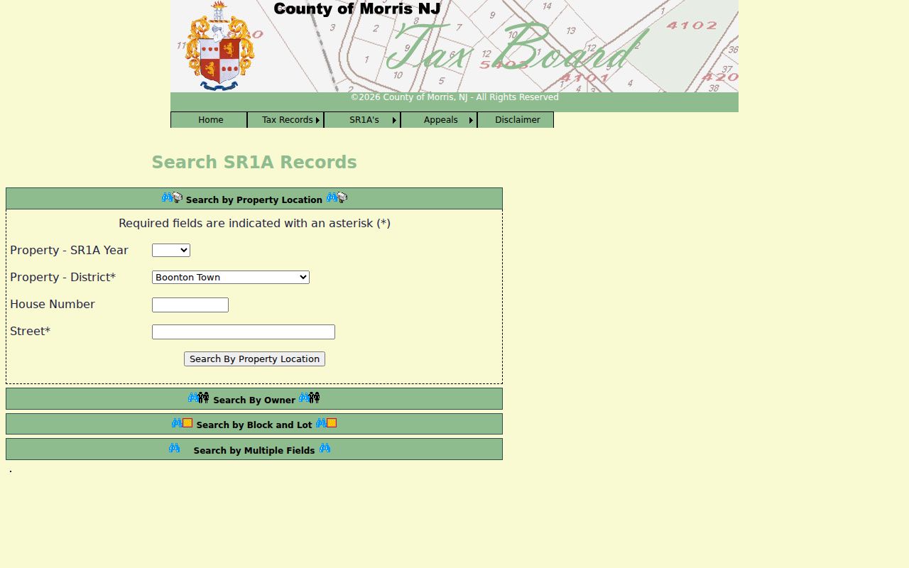
The fields support a recorded-property or sale question. They do not supply a ZIP-wide list of people, so retain the exact parcel and source date in the research notes.
Finding Parsippany-Troy Hills Records Within One ZIP Code
Once USPS and the municipality tool agree on the delivery and civil context, move from ZIP code to the narrower record keys that each portal actually accepts. A verified ZIP can guide an address search, but Morris County tax, GIS, deed, voter, and construction systems do not all offer the same postal filter. Keep the data source and its purpose beside every result.
- Validate the delivery address in USPS, then save the municipality result for the same address.
- Use the Morris tax search with tax year, district, street name, and house number, or use owner, block and lot, or prior block and lot where appropriate.
- Open the Morris GIS Parcel Searcher only after recording the tax result, and compare the map geometry with the address and block and lot.
- Use BrowserView for a defined recorded-instrument question, or make a narrow request to the appropriate custodian when the online route does not cover the needed record.
When the ZIP has narrowed the place to a particular road, the Parsippany-Troy Hills street directory explains the fuller address-by-address record chain. Postal geography should narrow the starting point, not replace the parcel and instrument checks.
Local Names in Parsippany-Troy Hills Postal Research
Local labels help find historical and postal variants, but they are not interchangeable jurisdictions. The Morris County hazard-mitigation profile identifies Mount Tabor, Rainbow Lakes, Lake Intervale, Lake Parsippany, Rockaway Neck, and Lake Hiawatha as township sections. Search a source-time appropriate version of Parsippany-Troy Hills, Parsippany, Troy Hills, Lake Hiawatha, or Mount Tabor when a directory, map, or postal record uses it, then report the exact returned label separately from the municipality result.
Township civic links include Lake Parsippany Property Owners, Glacier Hills Association, and Sedgefield Civic Association. Their public meeting pages, newsletters, or historical materials can provide community context for a dated place reference, but they are not membership rosters. Morris County Library and Historical Society sources can add maps, newspapers, organization histories, and obituary context without assigning a current person to a postal label.
ZIP Code Boundaries and Parsippany-Troy Hills Records Limits
A ZIP code is a postal delivery designation. ZIP+4 adds a more specific delivery segment to the base ZIP. A PO-box ZIP identifies a box-delivery arrangement and may not describe street delivery. A unique ZIP is assigned for a single high-volume addressee or organization. A carrier route is a delivery sequence, not a civil boundary or a resident list.
- ZIP versus ZIP+4
- The five-digit code identifies the broader delivery area; the added four digits narrow delivery handling for a particular address range or recipient.
- PO-box ZIP
- A code used for box service. Verify whether an address is street delivery or a box before drawing any geographic conclusion.
- Unique ZIP
- A postal assignment for one organization or high-volume receiver, not a general neighborhood boundary.
- Carrier route
- A mail-delivery grouping used by USPS. It does not determine township jurisdiction, parcel ownership, or residency.
For an unresolved edge address, retain the exact input and outputs, then contact the civil custodian responsible for the record. The township Clerk, Morris County Tax Board, Morris GIS, and the county records offices all answer different questions. A postal mismatch should lead to a jurisdiction check, not a conclusion about a person or property.
Documenting a Parsippany-Troy Hills ZIP Code Result
A reproducible ZIP code search note contains the exact input address, USPS city-state-ZIP result, lookup date, municipality result, and the record portal or custodian used next. For a parcel, add tax year, district, block, lot, qualifier, and the GIS layer date. For a sale or deed question, retain the instrument, book or page, party role, date, and verification status.
That record of the route is especially useful around 07005 and 07950, where official township material shows adjacent postal labels. It also avoids overstating unconfirmed overlaps such as 07834, 07869, and 07960. The careful result is not a broad ZIP conclusion, but a dated answer about one verified address and one specified record.
USPS identifies delivery information, while county property tools identify parcels and township or county offices control the records they keep. A Morris County tax result should therefore retain its tax year and district, and a GIS result should retain the layer or service date. If an old directory uses Lake Hiawatha, Mount Tabor, or Troy Hills, keep that historical label in the citation and compare it with the address-specific civil result instead of converting it to a modern postal assumption.