
Parsippany-Troy Hills Neighbors by Block
Public records can describe the setting around a Parsippany-Troy Hills address without establishing who lives in every household. Tax and GIS tools identify parcel keys, geometry, zoning, building attributes, and public land-use context. Permit and board records can date a construction or planning event. Historic maps and directories can add older street context. The right source depends on the question, and nearby parcels must be defined by a stated rule such as shared boundary, same tax block, same street segment, or a chosen map buffer.
| Block record | What it can show nearby | Access and limit |
|---|---|---|
| Tax block and lot search | Parcel keys, qualifiers, assessment-year data | County portal; tax year and district are required |
| Prior block and lot search | Earlier parcel identifier after reassignment | County portal; compare old and current keys |
| GIS parcel map and layer | Geometry, zoning, acres, construction and building attributes | Current county service; Daniel's Law redactions may apply |
| GIS buffer | Map features within a selected radius | Record the radius, layers, extent, and research date |
| FastTrack permits | Public application, permit, or violation chronology | Township portal; no full start date was confirmed |
| Planning and board records | Public decisions, maps, variances, and street context | Township records, department route, or OPRA request |
| Civic association links | Public organization and meeting-contact lead | Township sitemap; no membership rosters were located |
For Parsippany-Troy Hills neighbors, ownership and occupancy must stay separate. A current assessment or recorded instrument can be a title clue. It does not prove that every person connected to a parcel lives there, nor does it identify non-title household members. A blank field can be a privacy redaction, not a reason to fill in missing information from another source.
Map Parsippany-Troy Hills Parcels
The Morris County GIS Parcel Searcher is the most direct map route for a small Parsippany-Troy Hills block comparison. Its visible controls include Quick Search, map view, Advanced Data Search, Buffer in Feet, Submit, and Clear Buffers. Use it after recording the address and parcel key from the tax search. The map is an informational tool, not a survey, so parcel geometry should be checked against the tax key and recorded legal description when an exact boundary matters.
- Confirm the civil municipality for the reference address, then record the tax year, district, block, lot, qualifier, and situs wording from the county search.
- Locate that parcel in the Parcel Searcher and save the map extent, layer names, and date. Do not assume a postal label establishes the same boundary.
- Choose a clear neighbor rule: shared boundary, same tax block, same street segment, or a small measured buffer. State that rule with the result.
- Compare public structural fields such as zoning, GIS acres, year constructed, building description, square feet, property class, and dwelling count.
- For a public change over time, search the permit number or a dated board record. For a full named-street path, use the Parsippany-Troy Hills Street Directory.
The county's parcel feature layer exposes fields including property location, street address, zoning, land value, GIS acres, year constructed, building description, square feet, and dwelling counts. Values can have different update dates. They describe land and structures, not a reliable household roster.
Before comparing attribute fields, open the county's parcel feature layer and review the published field names and current service behavior.
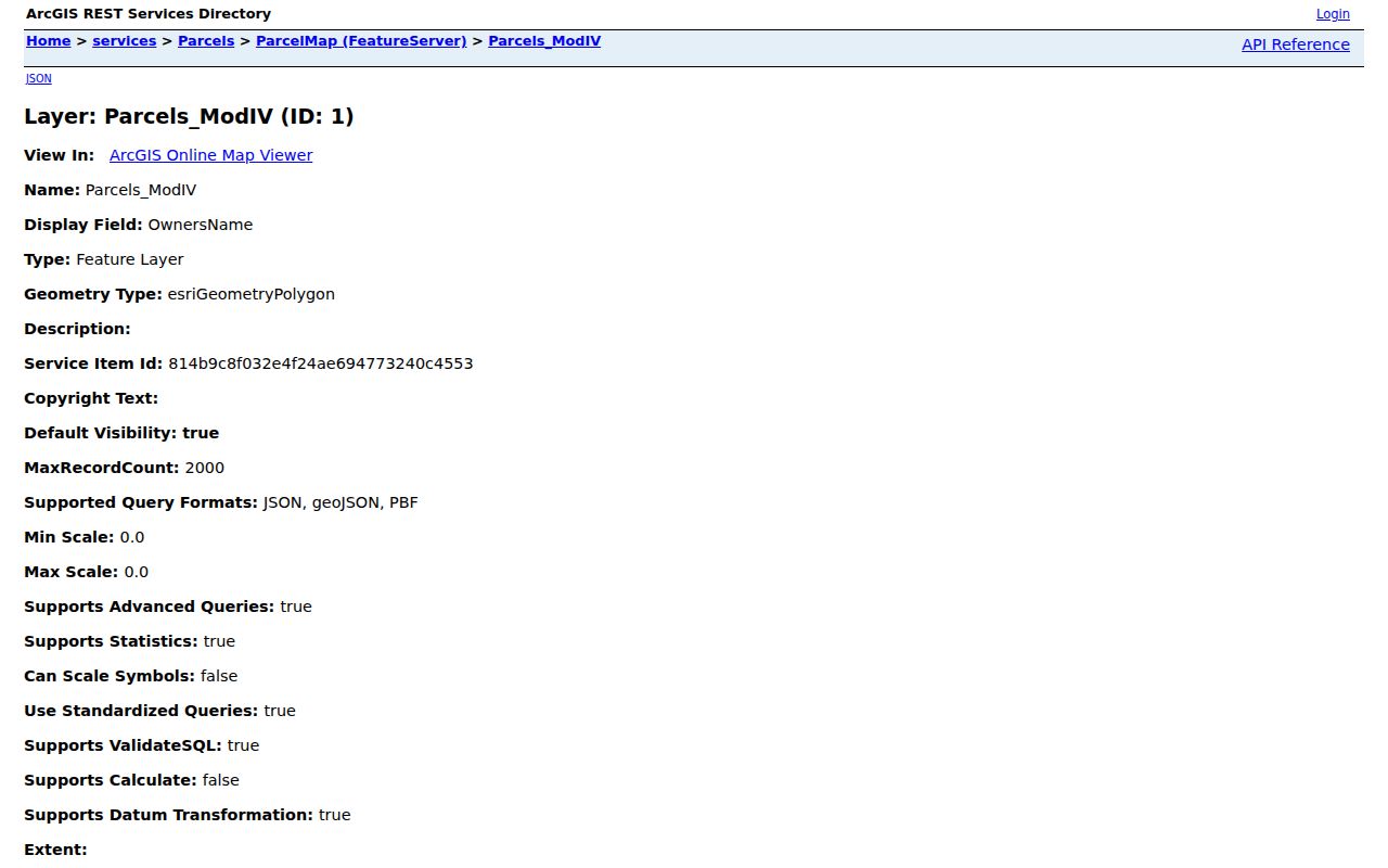
The feature-layer view supports a reproducible Parsippany-Troy Hills neighbors comparison because the parcel attributes and the selected geography can be recorded together.
Parsippany-Troy Hills Buffer Rules
A buffer is a measured radius, not another word for next door. In the Parcel Searcher, a small buffer can include parcels across a road, rail line, stream, or other boundary feature. Map browsing is visual and may show only a shared edge. Use the same radius for every comparison and record it with the search date. Clear the buffer before starting another address so that unrelated features are not carried into the next result.
For a search that returns an older parcel number, run the tax portal's current and prior block/lot modes separately. Then reconcile the result with the deed legal description and map references. This is especially useful after a split, merger, or qualifier change. The parcel feature layer's zoning, acreage, building description, and dwelling-count fields make better block comparisons than names or private contact details.
County GIS also provides road centerlines, railroads and stations, zoning and overlays, stormwater points, FEMA/FIRM resources, and official maps. Those layers can explain why nearby addresses fall under different public record systems. They do not change the parcel boundary or establish a resident's location.
Note: Save the reference parcel, buffer distance, map extent, visible layers, and service date with every block result.
Parsippany-Troy Hills Civic Leads
Public civic sources add useful human context to a Parsippany-Troy Hills block without assigning anyone to an organization. The township sitemap identifies Lake Parsippany Property Owners, Glacier Hills Association, and Sedgefield Civic Association, along with public-service and civic links. Those leads can point to public meeting notices, local history, or contact routes. The reviewed records do not establish each group's boundaries, membership policy, joining procedure, or a public member directory.
| Public civic lead | Appropriate block use | What cannot be inferred |
|---|---|---|
| Lake Parsippany Property Owners | Find a public contact or meeting-context lead through the township index | Whether a particular parcel holder or occupant belongs |
| Glacier Hills Association | Check a separately verified public contact or civic notice | The association boundary or a household list |
| Sedgefield Civic Association | Look for dated public neighborhood-history context | Member status from an address alone |
| Planning, Zoning, Historic Preservation and other boards | Locate public agendas, minutes, maps, variances, and project context | Private views, contact details, or a household roster |
Township boards can be especially helpful when a street changed because of a public application, traffic issue, subdivision, preservation question, park, or public facility. Cite the meeting packet and date. Board material is a record of civic action, not evidence of a resident's personal affiliation.
For the public civic starting points shown in the image, use the Parsippany-Troy Hills boards and committees page before seeking a dated meeting record.

The township civic page is a public-records route for Parsippany-Troy Hills neighbors research, while any association membership remains outside the available public evidence.
Parsippany-Troy Hills Neighbors Voter Limits
New Jersey's public registry-list statute describes name, address, date of birth, party affiliation, and voting history, while signatures and identification numbers have separate protection. That statutory list is not the same thing as the online registration checker. The official checker is intended for a person to verify that person's own registration, and no public street-wide search mode was confirmed. Do not capture or publish an individual's checker result.
A lawful county request is separate from using the checker. The statute describes a cost cap for an electronic list and restricts commercial or charitable solicitation; current procedure should be confirmed with the Morris County elections office before a request. Even a valid list may omit people who are not registered, inactive, newly moved, or protected. It cannot prove continuous residence or identify every household member.
The narrow rule is simple: do not join voter names to parcel data to create a block roster. For a correction, the voter should use the official update process or contact the custodian. A researcher who sees a discrepancy should retain the original source and report it to the responsible office.
Compare Parsippany-Troy Hills Neighbor Sources
Official records and commercial neighbor tools serve different purposes. County and township sources state their record family, field limits, custodian, and date context. Commercial products commonly combine parcel, directory, marketing, and historical-address material. That can create stale addresses, same-name matches, or false proximity. Neither category should be used to bypass a redaction or to create an occupancy claim that the public record does not support.
| Source category | Useful for | Core caution |
|---|---|---|
| County tax and GIS records | Parcel keys, current geometry, land and building attributes | Assessment or map information is not occupancy proof; fields may be redacted |
| Recorded deeds and Vault material | Recorded transfers and legal-description continuity | A conveyance does not identify every household member or move date |
| Township permits and board records | Public project and structure chronology | An applicant, contractor, or agent is not automatically a resident |
| Commercial neighbor categories | Possible starting leads that need independent checking | Data may be stale, merged, inaccurate, or incomplete |
The County Clerk, Tax Board, GIS staff, and the relevant township department remain the better route for a question about a record's meaning. If a map field conflicts with a deed or assessment result, cite both dates and ask the custodian about the discrepancy rather than selecting the more convenient result.
Parsippany-Troy Hills Records Geography
One street address can sit in several overlapping geographies: current parcel, postal delivery, Census boundary, historic map, zoning district, tax district, school or fire service area, and civic neighborhood label. They can differ. Use the New Jersey municipality lookup for the civil municipality and USPS only for delivery questions. A mailing address or polling-place ZIP is not boundary proof.
Parsippany-Troy Hills research also benefits from local labels. Mount Tabor, Rainbow Lakes, Lake Intervale, Lake Parsippany, Rockaway Neck, and Lake Hiawatha can appear in historical or civic material, along with Parsippany and Troy Hills. Search variants help surface a record, but the returned label should be reported as returned and then compared with the contemporary municipal assignment.
The township sitemap is a practical way to find civic and public-service links without assuming that any group marks a legal neighborhood boundary. Open the Parsippany-Troy Hills sitemap before pursuing a public contact or board resource.
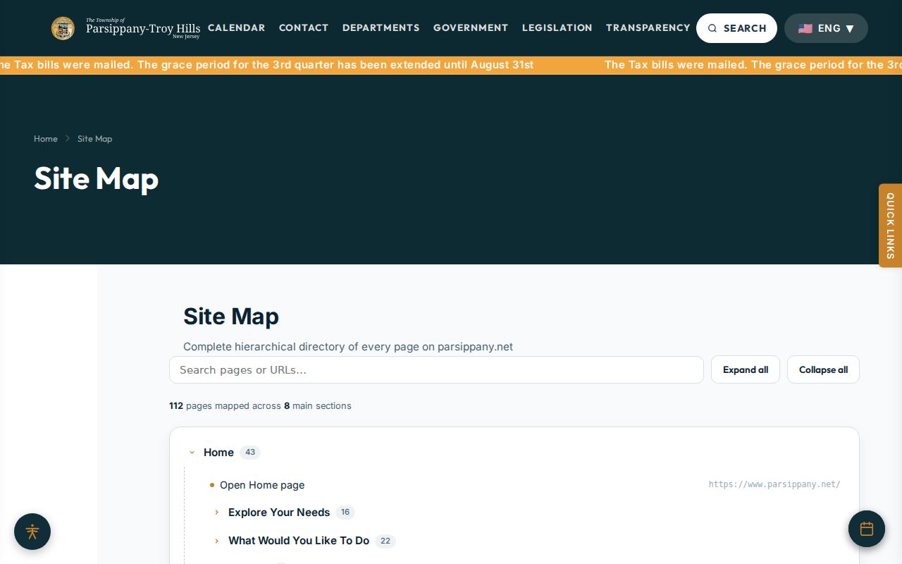
The sitemap image shows why Parsippany-Troy Hills neighbors research should use public civic links as context, not as evidence that a private household belongs to a group.
Protect Parsippany-Troy Hills Neighbors
Several address records remain private or restricted. Non-title household members, utility customers, postal-delivery data, DMV address data, protected official addresses, and confidential survivor addresses are not a public block directory. Morris GIS reports that owner and owner-address fields in newer services are redacted under Daniel's Law until further notice. A missing value should be cited as a limit, not treated as a gap to work around.
The New Jersey Address Confidentiality Program provides an eligible participant with a substitute address within the program's scope. Public-record redactions may also cover personal identifiers, month and day of birth, personal contact details, financial information, signatures, minors' information, and other protected data. Keep only the information needed for the narrow civic or historical question and provide a custodian route when a record is restricted.
Lawful use. Use Parsippany-Troy Hills neighbor records for civic awareness, public history, and a careful block comparison. Do not use them to watch, threaten, harass, or harm any person.
For a public-record request, identify the correct custodian and ask for a narrow date range and record type. A county request does not automatically cover township, court, police, or state material. That scope check protects both the record and the people connected to it.